ALGERIA SPLENDORS
Site facts and inscription data are from UNESCO's listing of the M'Zab Valley; visiting rules for Beni Isguen are from the ksar's own tourism office; the water system is described from the valley protection office (OPVM) — all checked 14 November 2026. Where sources diverge (foundation years above all), this guide gives centuries and order rather than a false precision, and visiting hours are stated as last published — reconfirm them before you travel.
A pentapolis in the stone desert
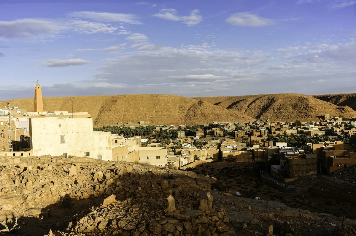
The M'Zab is a short, hard valley cut into a limestone plateau, some 600 kilometres south of Algiers, where the paved north ends and the Sahara begins in earnest. A thousand years ago it was a refuge, and its people arrived by a road of defeats: the Ibadites — a distinct, rigorous branch of Islam — had built an imamate at Tahert, in the Algerian highlands; when Tahert fell in 909, the survivors withdrew first to Sedrata, near Ouargla, and then, in the following century, to this stony valley, the Chebka, precisely because it was defensible and unwanted. There they built one of the most complete urban societies on Earth.
Between 1012 and 1350 they founded five ksour (singular ksar, a fortified town): El Atteuf, the eldest; Bou Noura; Ghardaïa, today the valley's capital and market heart; Melika; and Beni Isguen, the holy city, walled and gated. Together they are called the Pentapolis. UNESCO inscribed the valley in 1982 under criteria honouring exactly this: a traditional human habitat, intact, whose building techniques and social organisation have continued essentially unbroken since the 11th century.
How a ksar works
Every ksar is built to the same grammar, and once you see it, the towns read like sentences in one language.
The pyramid. Houses climb a hill in concentric rings around the mosque, each roof kept below the one behind it so that no household's terrace is overlooked and every home takes its share of light. UNESCO's listing describes the result as a standardised, cubic house type arranged for two things at once: equality, and the preservation of family privacy. At the summit stands the mosque — fortress as much as sanctuary, the town's last redoubt, complete with arsenal and grain silo — and its pyramidal minaret, which is also a watchtower over the valley.
The rules. Building in the old towns follows customary law administered by the community: heights, sightlines, water, shade and the rights of neighbours are regulated in detail that predates modern planning codes by nine centuries. It is not folklore; it is the operating system of the place, and it still runs. Houses are maintained, rebuilt and extended inside the same grammar, which is why a photograph of a ksar mixes centuries without showing a seam.
The cemetery and the palm grove. A ksar is one term of a triptych that UNESCO places at the heart of the listing: the town, its cemeteries, and its palm grove. The cemeteries encircle the walls — graves anonymous, uninscribed, marked with pottery shards — and their ground is consecrated forever: at Ghardaïa, the dead quite literally hold the city's boundary. Below lies the palmeraie, where the same families keep garden plots and what the valley's own protection office calls a second, summer city among the date palms. Town and grove, stone and green, winter and summer — the M'Zab lives in the movement between the two. One last detail teaches the rest: the market stands by the gate, away from the mosque — commerce at the threshold, prayer at the summit.
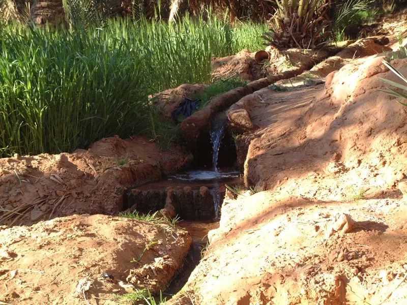
The water. The valley's river, the oued M'Zab, is dry almost always — the valley sees perhaps ten days of rain a year — and everything depends on the rare hours when it is not. This is not the foggara of the Touat, the underground gallery of our Foggara guide: the M'Zab's system does not drain an aquifer, it arrests a flood. The valley's protection office (OPVM) documents the Ghardaïa works in detail: a system in place for more than seven centuries, its organisation attributed to the scholars Ba Mhamed Abou Sahaba (1273) and Hammou Oulhadj (1707). Where two wadis converge at a place called Amlaga, the first works slow the flash flood; dams feed the water table; underground channels pierced with aeration and cleaning shafts carry the water on; and it enters each garden through openings sized by the number of palms and the area of the plot — proportion, made physical. A commission of sages, the Oumanas, manages the division, and watchtowers around the palm grove exist to pass the alarm between ksour when a dangerous flood is coming. The surplus is not wasted: it recharges the wells that carry the towns through the dry years. In a valley with almost no rain, the true founding monument is not a wall. It is a water rule everyone obeys.
The architects who came to learn
The M'Zab's fame travelled far beyond the desert, and this journal reports the connection at exactly the strength of its sources. UNESCO's listing itself — criterion (ii) — states that this model of habitat influenced 20th-century architecture and urban planning, naming Le Corbusier, Fernand Pouillon and André Ravéreau. Le Corbusier's visit is documented fact: he came to Ghardaïa in 1931 and brought back sketches. How deep the influence runs in his built work is another matter — the scholarly literature debates it (one much-discussed hypothesis compares the Sidi Brahim mosque at El Atteuf to Ronchamp; it remains a hypothesis, and we print it as one).
The architect the valley truly formed was André Ravéreau, who discovered the M'Zab in 1949–50 and spent a career on its lesson: an article, "Le M'Zab, une leçon d'architecture", in 1951; the valley's master plan in the early 1960s; buildings in Ghardaïa itself; and the book Le M'Zab, une leçon d'architecture (1981). A scholarly study credits his initiative for the UNESCO inscription itself. His own summary is the honest one, and it is documented, so we can quote it: "Like everyone, I received the seduction of Ghardaïa before analysing it." What the moderns took from the valley, on the evidence, is a set of principles rather than forms: compactness against the heat, shade and terraces as climate machinery, the governance of sightlines and privacy, and old towns extended without being betrayed. The principles were already built, in stone and mud-brick, by a religious community in the Sahara — nine centuries before modernism came looking.
Visiting: the guest's protocol
The M'Zab is not a monument that tolerates visitors; it is a society that receives them, on its terms. Those terms are clear, and honouring them is the entire price of one of the great travel experiences of the Sahara.
Go with a local guide — in Beni Isguen, it is the rule. The ksar of Beni Isguen runs the valley's most formal welcome, documented by its own tourism office: you present yourself at the guides' office by the East gate (Bab Chergui), and the town is visited in the company of an official local guide. The office's visiting hours are 8:30–12:30 and from 16:00 until the dusk prayer, and the ksar closes to visits on religious holidays. This is not a commercial upsell: the guide is your introduction, your interpreter of what you are seeing, and the guarantee that the visit stays inside the customs. In the other ksour a local guide is the established and strongly recommended practice rather than a documented requirement — take one anyway; the towns are illegible without one. There is no lodging inside Beni Isguen's walls: visits end before nightfall, as they have since the gates were built to close.
Dress modestly. The Beni Isguen office's rules are explicit: no short or tight clothing. The working detail, from operators who bring visitors weekly: long trousers and sleeved tops for men; loose clothing covering arms, legs and chest for women. It is the valley's universal dress code, not a special demand on foreigners.
Photograph places, not people. At Beni Isguen the rule is official and simple: buildings and landscapes yes, photographing passers-by no — and the town's residents are not a subject at all. Elsewhere in the valley, photograph the architecture, and people only with explicit consent, asked and granted. The ksour photograph beautifully; their inhabitants did not move into a postcard. Your guide will tell you what is welcome street by street. Obey the street you are in.
Respect the hours. Prayer times reshape every ksar's day, Friday most of all — Beni Isguen's celebrated auction market, supervised by the town's council of clerics, does not even sit on Fridays. Come in the morning, take the market of Ghardaïa at its lively midday, and do not plan a sunset stroll through a holy city that has gone home to pray. And do not expect mosque interiors: no source we can verify opens them to non-Muslim visitors here, so this guide does not promise them.
Buy in the valley. Ghardaïa's market is the commercial heart of the pentapolis — carpets, pottery, dates and the valley's craftwork — and the souk around it is where the M'Zab meets the caravan trade it has served for centuries. Prices are negotiated with good humour; the guest's protocol includes being a fair customer.
Getting there, and when
Ghardaïa is the gateway: roughly 600 kilometres south of Algiers by road — a full day's drive, seven to nine hours, across the Atlas and the high plateau on the trans-Saharan axis — or a domestic flight of about an hour and a half to Ghardaïa–Noumérat–Moufdi Zakaria airport, some 20 kilometres from the town (frequencies change; verify before building an itinerary on them). Most travellers sleep in Ghardaïa, in hotels outside the old towns, and visit the ksour by day with their guide. The valley is a desert climate of extremes: spring and autumn are the humane seasons, winter days are kind and its nights cold, and summer heat in the stone streets is a serious undertaking. The M'Zab combines naturally with nothing — it is a destination, not a stopover — though our guide to Algeria's seven UNESCO sites places it in the country's full heritage arc, and the escort guide explains where the valley sits inside the rules for travelling the Algerian South.
Why it matters
Every heritage list has beautiful dead cities. The M'Zab is something rarer: an intact medieval urban civilisation that never died — five towns where the founders' water still flows by the founders' rules, where the building code is a thousand years old and enforced by neighbours, where privacy, shade and light are distributed like justice. You do not visit the M'Zab to see how people once lived in the desert. You visit to see how a society can decide, together, how to live — and then simply keep deciding, every day, for a thousand years.
Frequently asked questions
What are the five ksour of the M'Zab? Ghardaïa, Beni Isguen, El Atteuf, Bou Noura and Melika — founded between 1012 and 1350 by the valley's Ibadite communities. Ghardaïa is the largest and the commercial centre; Beni Isguen is the holy city, the most strictly kept.
Can I visit the old towns on my own? At Beni Isguen, no: the visit is made with an official local guide from the guides' office at the East gate, in the published hours (8:30–12:30, and 16:00 to the dusk prayer; closed on religious holidays). In the other ksour a guide is the established practice and is strongly recommended. Treat the guide as part of the place's fabric, not an optional extra.
What should I wear, and can I take photographs? Dress modestly in the old towns — covered shoulders and legs. Photograph the architecture freely where your guide confirms it; photograph people only with their explicit consent, and accept that some streets and moments are not for cameras at all.
How far is Ghardaïa from Algiers? About 600 kilometres by road — a full day's drive — or a short domestic flight. Verify current flight schedules before planning around them.
When is the best time to go? Spring and autumn for balance; winter days are pleasant and nights cold. Summer is extremely hot. Mornings are the best hours inside the ksour in every season.
Algeria Splendors writes from Algeria. Companion reading: Algeria Without the Crowds: Seven World Heritage Sites · The Honest Map for Travelling Algeria's Sahara